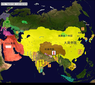
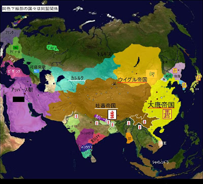
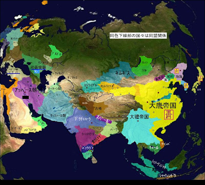
It has the maps of the world (well, Euroasia for the period it has been able to cover up to this date -- AD1215 when Mongolia was united by Temujen aska Genghis Khan), spaced at 5 year intervals (and at 50 years for B.C.). I believe it is still a work in progress and more maps will be filled for the period between 1215 and 2000.
Animation for such country evolution will be treated in future posts. It is especially useful to understand the periods of 16 states and N&S (i.e. 300-600AD) and that of 5 Dynasties 10 States (900-1000AD).
I have selected a few of its maps here for illustration
1000 BC: Shang dynasty

550BC: the year of Confucius and the Buddha, Persian Empire expanding, while China and India were still divided

200BC: India and China both united

5AD: Palestine/Israel under Roman Empire, Han close to its peak after defeating the Huns

210AD: Immediately after the Battle of Chibi, Liu Bei acquired the State of Jin (Hubei today)

690AD: The Empire of Da Zhou (Wu Zetian, the first woman empress in China, interlaced in Tang Dynasty), the peak of any Chinese empire. The map here is a bit dubious, as it included tribute states such as Japan and part of India (Indus River, today's Pakistan, which I think is a bit of a stretch)

790AD: when the Tibetan Empire was at its peak (I bet not many people are aware of Tibet's brilliant footprint in history. Given the harsh environment it originates and the small population, the Buddhist Theocracy probably conquered a larger area (per original ethnic population) than Genghis Khan's empire did.)

880AD: Dali Empire (capital at today's Lijiang/Dali area) at its peak

2003AD: the 2000 onward are on a year-by-year basis. you may think nothing interesting is happening, but look at the two areas with Stars and Stripes flag across these years

It also has very nice series of maps for Africa, East Asia and Europe (years covered are still to be completed, but impressive enough to overwhelm any maplover)
Enjoy!
No comments:
Post a Comment