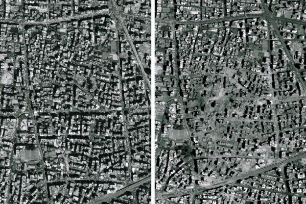
The location is about 3.5km NE of Beirut Airport.

You can zoom in for the pre-bombing satellite image with Google map location at 33.853N, 35.509E.
Zoomed in the affected quarter,
This is probably where the Hezbollah headquarter building was located. But it is fair to say that
- Hezbollah is not stupid enough to store weapon at its headquarter building in Beirut
- Much more than that single building was levelled.
Update: wiki has the hi-resolution picture of the damage (not globalscape picture is rotated by 90 degrees. N is to the left hand side)
2 comments:
Those zoomed images really help give an idea of the extent of the damage that must have taken place.
NYT has labelled pictures, as usual NYT went in length to explain that the bombing was legitimate. But there are still quite a few levelled buildings unlabelled.
Post a Comment